
![]()
![]()
The goal of mapiso is to ease the transformation of
regularly spaced grids containing continuous data into contour polygons.
These grids can be defined by data.frames (x, y, value), sf
objects or SpatRasters from terra.
mapsio is a wrapper around isoband.
You can install the released version of mapiso from CRAN with:
install.packages("mapiso")Alternatively, you can install the development version of
mapiso from GitHub with:
remotes::install_github("riatelab/mapiso")library(mapiso)
library(terra)
#> terra 1.7.29
library(mapsf)
r <- rast(system.file("tif/elevation.tif", package = "mapiso"))
isor <- mapiso(x = r)
mf_theme(mar = c(0, 0, 0, 0))
mf_raster(r)
mf_map(isor, col = NA, add = TRUE)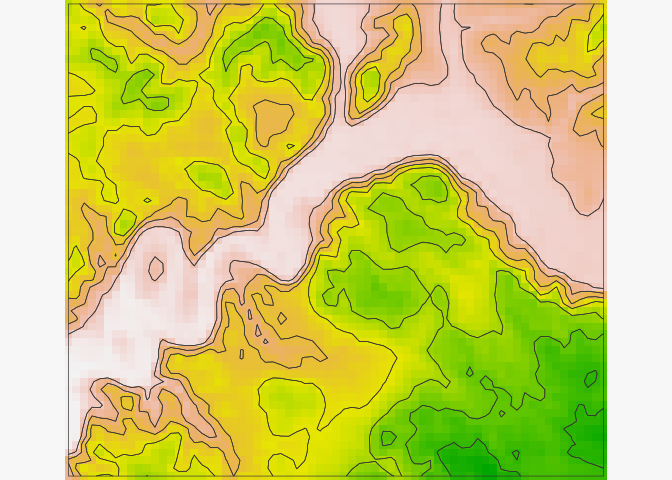
library(mapiso)
library(sf)
#> Linking to GEOS 3.9.0, GDAL 3.2.2, PROJ 7.2.1; sf_use_s2() is TRUE
library(mapsf)
# gridded data
s <- st_read(system.file("gpkg/elevation.gpkg", package = "mapiso"),
             layer = "elevation", quiet = TRUE)
# mask
m <- st_read(system.file("gpkg/elevation.gpkg", package = "mapiso"),
             layer = "com", quiet = TRUE)
# custom breaks
bks <-c(98,100, 150, 200, 250, 300, 350, 400, 412.6)
isos <- mapiso(x = s, var = "elevation", breaks = bks, mask = m)
mf_map(isos, "isomin", "choro",
       breaks = bks, border = NA,
       leg_title = "elevation")
mf_map(m, col = NA, add = TRUE)
mf_map(s, cex = 1, pch = ".", col = "grey20", add = TRUE)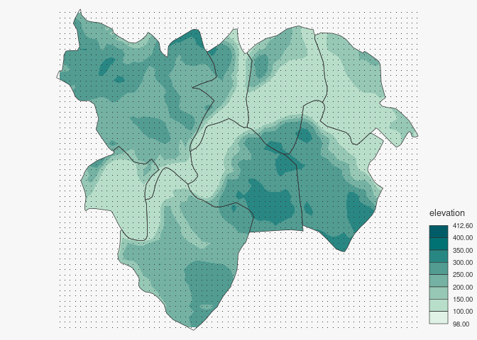
library(mapiso)
library(mapsf)
d <- read.csv(system.file("csv/elevation.csv", package = "mapiso"))
head(d)
#>          x       y elevation
#> 1 586231.3 6431677  282.0299
#> 2 586481.3 6431677  263.7194
#> 3 586731.3 6431677  244.9597
#> 4 586981.3 6431677  222.3232
#> 5 587231.3 6431677  211.1522
#> 6 587481.3 6431677  232.1604
isod <- mapiso(x = d, var = 'elevation', coords = c('x', 'y'), crs = 'epsg:2154')
bks <- unique(c(isod$isomin, isod$isomax))
mf_map(isod, "isomin", "choro", breaks = bks, leg_title = "elevation")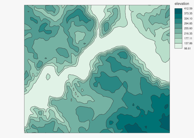
One can contribute to the package through pull requests and report
issues or ask questions here.
This project uses conventional
commits and semantic
versioning.